Seiser Alm Bahn: Via Sciliar, 39, 39040 Siusi BZ, Italië
Monte Petz | rondwandeling: 6.5 uur
Uitdagend
Mountain hiking in the Dolomites
Hiking towards the Schlernmassif
07:00 on Tuesday morning. The alarm goes off. It would be the best day of the week for a hike to the top of the mountain that we have been looking at for several days. During this vacation week in the Dolomites, summer made way for autumn. The 300 days of sunshine per year for which the Dolomites are famous were now filled with heavy clouds. That doesn't have to be a problem if you go hiking in the mountains!
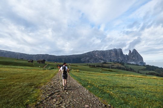
After a quick but hearty breakfast we drove back to the Seiser Alm Bahn and then one of the first rides to the Puflatsch Plateau, our starting point for the long hike. Fragments of large clouds drifted along the huge mountain flank of the Schlernmassief.
The hike through the meadow and the forest
From the top station of the Seiser Alm Bahn follow the NR. 10 to the right. This path starts with a piece of paved road, and soon turns into easily passable hiking paths through meadows with cows. You will be accompanied by the cheerful sound of the bells and the contours of the Schlern become sharper and sharper.
After about an hour we arrive at a mountain hut, the Prosslinger Schwage. Unfortunately the hut wasn't open yet when we passed but we could go to the toilet. Between the mountain meadow behind us and the mountain massif in front of us there is still a kind of valley full of trees. On the other side of this forest you can see a steep winding mountain path going up the Schlern. That promises good.
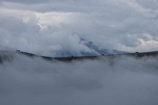
During the walk through the forest we are caught by a cloud. The mist cools down nicely and in the meantime we climb a lot. Only when we have really climbed a lot and leave the forest behind us, we see how high we are now because the nebula breaks open.
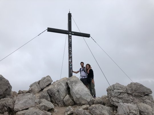
The route to the summit: Monte Petz (2564m)
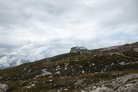
The last hour of the trail is still very easy to find and walk on, but you make a lot of altimeters here. They are mostly large boulders you walk on, until you end up at the very top of the flank you can see from the valley. From there you cross in 10 minutes to the middle of the Schlern and walk towards Rifugio Bolzano. This is a beautiful massive mountain hut from 1885 where you can eat and sleep with a great view. With a little imagination it looks like a small Hogwarts. By the way, this rifugio in the valley is already indicated on the routes so getting lost is not in it :)
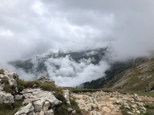
Before we dive into the Rifugio for a hearty mountain lunch we walk on to the top of the Schlern massif, Monte Petz. That is still 20 minutes from the mountain hut and is a relatively easy climb. Because of the rising rain and clouds the view was moderate, but the climb was definitely worth it!
Hiking back to the Seiser Alm
If you stay in the area Seiser Alm you get free bus tickets. A good option was to descend the other side of the mountain to the village of Völs am Schlern, where you can easily take the bus back to Seis am Schlern. Please note, you descend an extra 700 meters because you don't go back by cable car.
We walked back to the cable car ourselves and did about 6,5 hours over the whole hike. In total we climbed 1140 meters, this is because you first descend from the cable car before you go up to the top. The difference in height between the cable car and the summit is 700 meters.
The hiking trail actually has everything in it. Mountain huts on the route, alpine meadows, forest and the ascent to a summit. Highly recommended, also for families with children from 13 years.

Hiking routes | Tips and numbers
Route Numbers 10, 1 & 5
For this hike it is best to start at the top of the Seiser Alm Bahn cable car. From there you take hiking route 10. Above the forest on the mountain follow route 1 in the direction of Rifugio Bolzano and from there you can easily find the top. Back we have changed to hiking route 5 along the Saltner Hütte. Descending on the other side of the mountain can be done with hiking route 3 or 1.
Voor deze bergwandelroute gebruikte wij de wandelkaart: Seiser Alm Kompass nr. 067