ascent: 2.5 hour| descend: 1.5 uur
Average, final steps are challenging
Mountain hiking in the German Alps
Hiking routes at the Tegelberg
Although you may not immediately think of Germany and mountain hiking, there are true peaks to be found in the south. We know the Zugspitze as the highest mountain in Germany, but there is more. If you want to hike in the mountains of Germany, the Tegelberg is an ideal location only 2 hours from Munich and it is located at the foot of the German Alps, near Austria. With its 1,720 meters high absolutely not big bully, but all the more in entertainment!
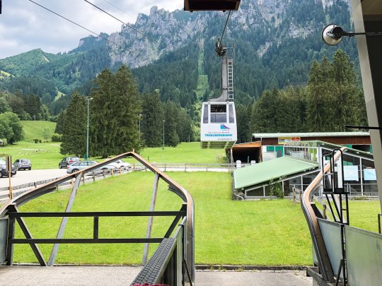
At the bottom of the mountain it is easy and paid parking, after which you immediately have to make the choice to walk up like a real mountain goat or to buy a ticket for the cable car. Hiking in the mountains of Germany is affordable. For one-way Tegelberg it costs you as an adult €15 and a return ticket €23. The advantage is that you can use the return ticket for a year! So if you, like me, decide to take the cable car up (there was a thunderstorm coming) and walk down, you can do the route the other way around later that year.
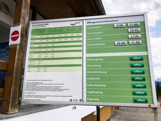
Hiking route Tegelberg
check the route map below this blog!
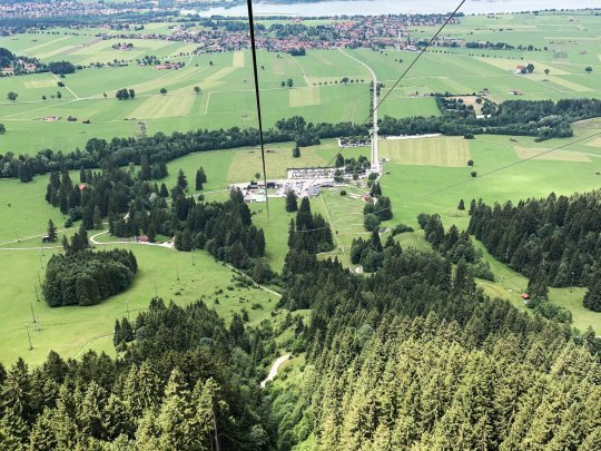
At the office I immediately went for a return ticket. It was going to rain and storms within 2 hours, even though it seemed unlikely given the sunbeams at the top of the mountain. But anyway, make sure you take it safe when you go hiking in the mountains! After 5 minutes of waiting you get into the gondola, and within 10 minutes you are almost at the top. Still a chance to hike a little uphill ;).
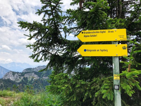
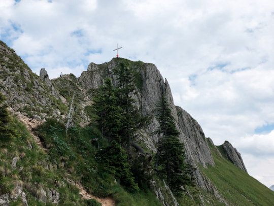
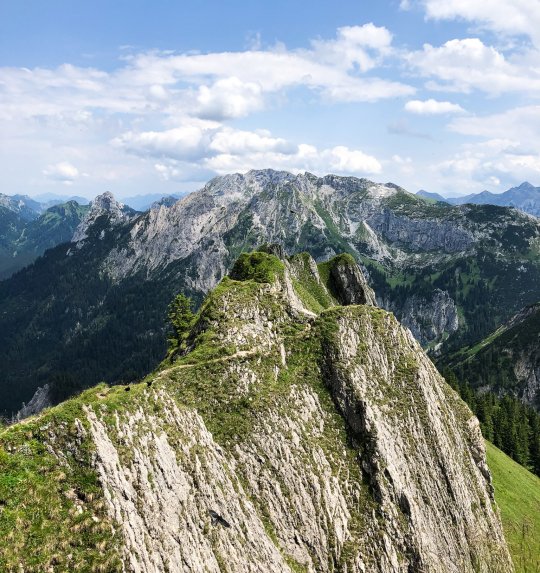
Once you get to the top you will have the opportunity to climb even further and walk the Koningsrunde am Tegelberg. A 35 minute hike takes you to a place where your view is truly phenomenal! Halfway through this Kingsrunde you come to a yellow sign that says 'Branderschrofen Gipfel'. This leads you even further to the Braderschrofen summit of 1879 meters. Spicy piece of climbing over rocks, so don't forget to put on your hiking boots!
Luckily you are occasionally accompanied by steel wire, because here you climb over a kind of mountain ledge with deep abysses left and right. This last part up is therefore not really a family activity, but fortunately you also have a beautiful view from a little below.
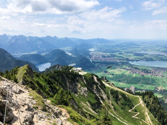
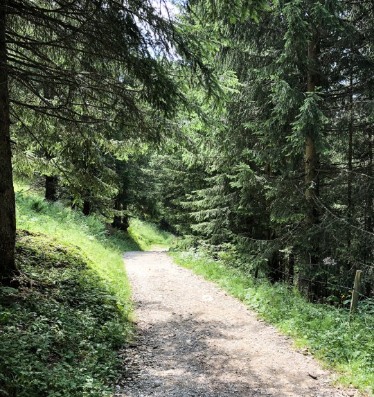
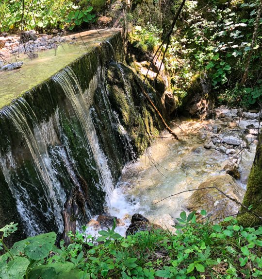
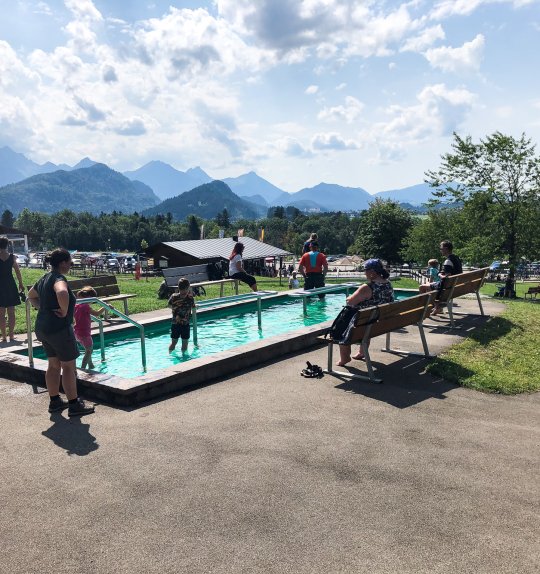
After this climb follows the road down. You can choose from no less than 5 hiking routes! I went for route 2, 'Kulturpfad Schutzengelweg'. Chop Chop, in 1 line down over a beautifully signposted path. Normally I like to hike above the tree line, but also between the conifers I love the nature here! Once in a while you can easily cut off pieces and descend a bit faster. When I was almost at the bottom of the mountain I heard a stream flowing. I had run out of 0.5 liters of water for some time and my feet could use some cooling as well! So the last 30 minutes were extra fun and of course I ended this walk with a delicious ice cream in a cold footbath.
Hiking routes| Useful information
Routenumbers 1 & 2
If you take the cable car for this hike up into the mountains, you can walk from the station with route 1 to the top for the best views. Back down you have many options. I walked route 2. Route 3, 4 & 5 are more extensive hiking routes with which you can hike up and down the Tegelberg. Above and below the mountain the routes are clearly signposted.